Mapa de Paisaje físico-geográfico del Estado de Puebla (2014)
Sinopsis
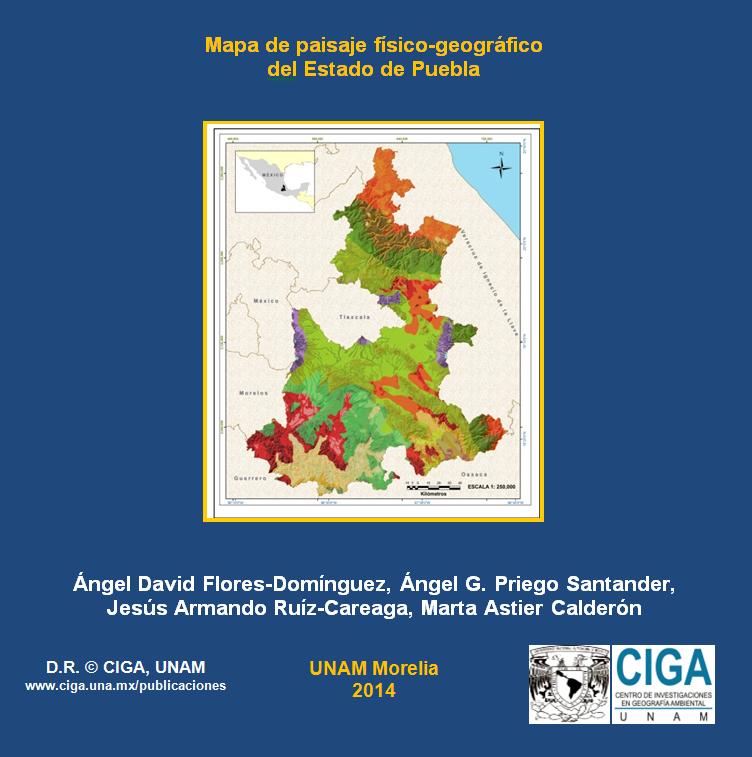
El mapa contiene la distribución espacial de los paisajes físico-geográficos del estado de Puebla a escala 1:250 000. Cada unidad de paisaje está definida en tres niveles jeráquicos: Localidades, Parajes Complejos y Parajes Simples. El mapa se acompaña por una leyenda, metadato y arbitrajes realizados. Para todo el estado, se clasificaron 291 localidades y 717 parajes simples. El análisis de las unidades revela que más de 55% del territorio corresponde a montañas o a lomeríos con génesis tectónica o volcánica. En relación a la litología, los depósitos aluviales predominan en 28% del estado. El clima predominante es del tipo templado subhúmedo (32%) y aproximadamente 50% posee inclinaciones del terreno entre 10 y 30°.